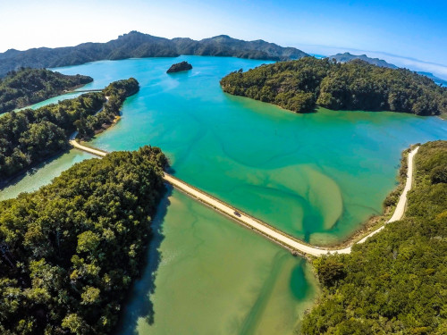
 Whanganui (Westhaven) Inlet is a relatively unmodified, large-sized (2741 ha, third-largest of its type in the South Island), macrotidal (3.1 m spring tidal range), shallow (mean depth ~1-2 m at high water), well-flushed (residence time <1 day), seawater-dominated, tidal lagoon type estuary. It has a single wide tidal opening (1.5 km), a large well flushed central basin, several islands, and two main arms (5 km and 7 km long, 1-2 km wide), each with many small arms where streams enter the estuary, and which are often flow constricted by road causeways. The subtidal zone comprised 769 ha (28%) of the estuary area.
The catchment is 91% native forest, and the estuary is perceived to be near-pristine.
There has been some historical loss of high value saltmarsh habitat due to reclamation and drainage around margin areas (~60 ha), with resulting shoreline modification (e.g. seawalls, bunds, roads) now restricting the capacity of saltmarsh to migrate inland in response to predicted sea-level rise.
Broad-scale mapping using the National Estuary Monitoring protocol was conducted in 2016 and a fine-scale survey in 2016-17.
More information and monitoring data is also available on the LAWA website.(external link)
For easier viewing use this link to open the report in a new window.
Last modified: